The Research
The essay that started the project
The Blue Patch Initiative grew out of a research paper. In "Causes and solutions of the decline of lakes in Gurugram", written for the Research Scholars Program of Harvard Student Agencies in collaboration with Learn with Leaders, Devvrat reviewed academic studies, government reports and case studies, and compared satellite images of Wazirabad Lake before and after its restoration.
- What is driving the decline. Encroachment and urbanisation of catchments, sewage inflows, and the loss of the natural drainage that fed the lakes.
- What restoration needs. Legal protection, sewage treatment, ecological restoration with planted buffers and native aquatic plants, and community engagement.
- What Wazirabad shows. Restoration brought fencing, tree planting and treated inflow, but the water surface measured on satellite imagery was about a third smaller in 2024 than in 2014.
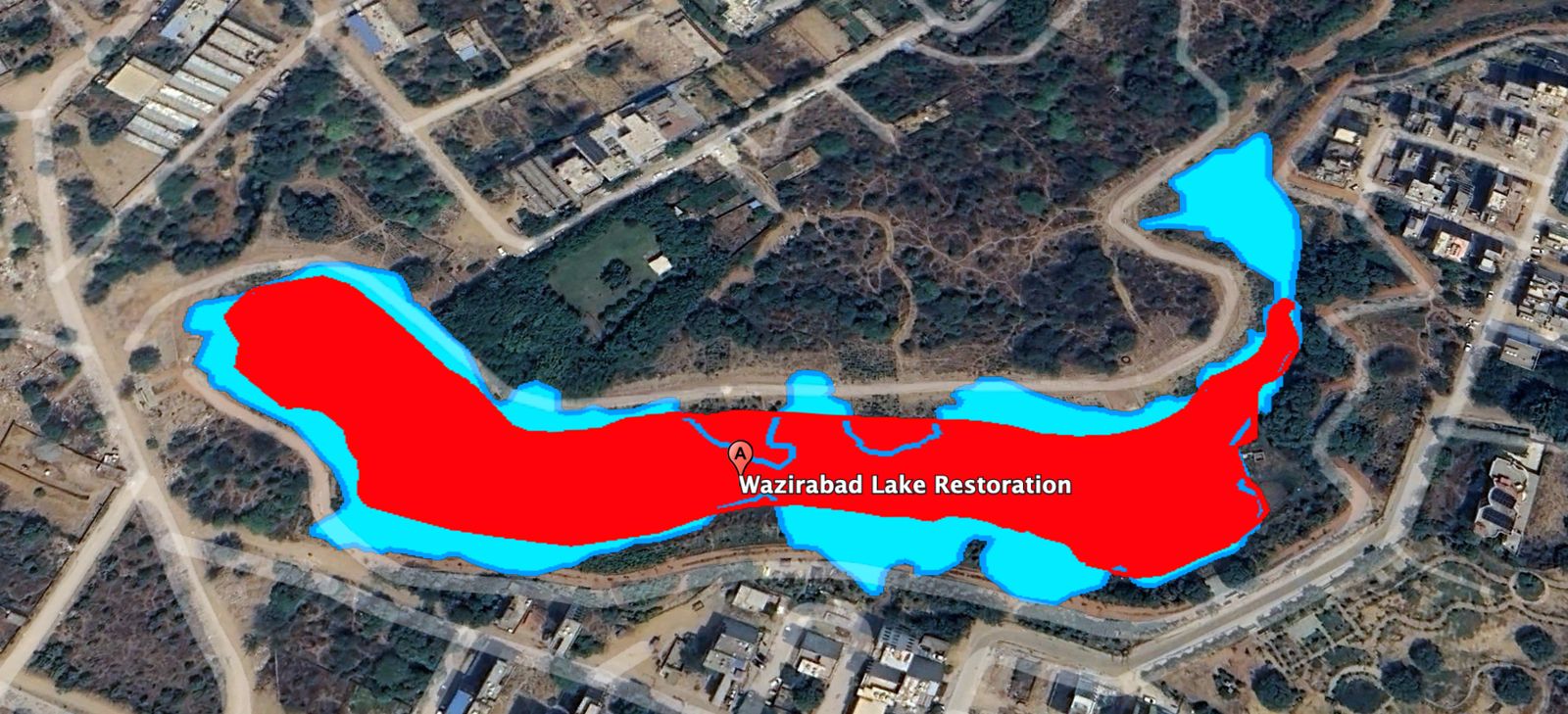
Perimeter, 2024
938 m
1,437 m in 2014
Area, 2024
15,949 m²
24,558 m² in 2014
Change in area
35% smaller
8,609 m² less water surface