About the Pond
This pond sits at 155T, Sector 68, Gurugram, nestled between a residential colony and The Vivekananda School. It is officially mapped under Haryana's urban water body registry and is one of the remaining pieces of the natural drainage network that once sustained this landscape.
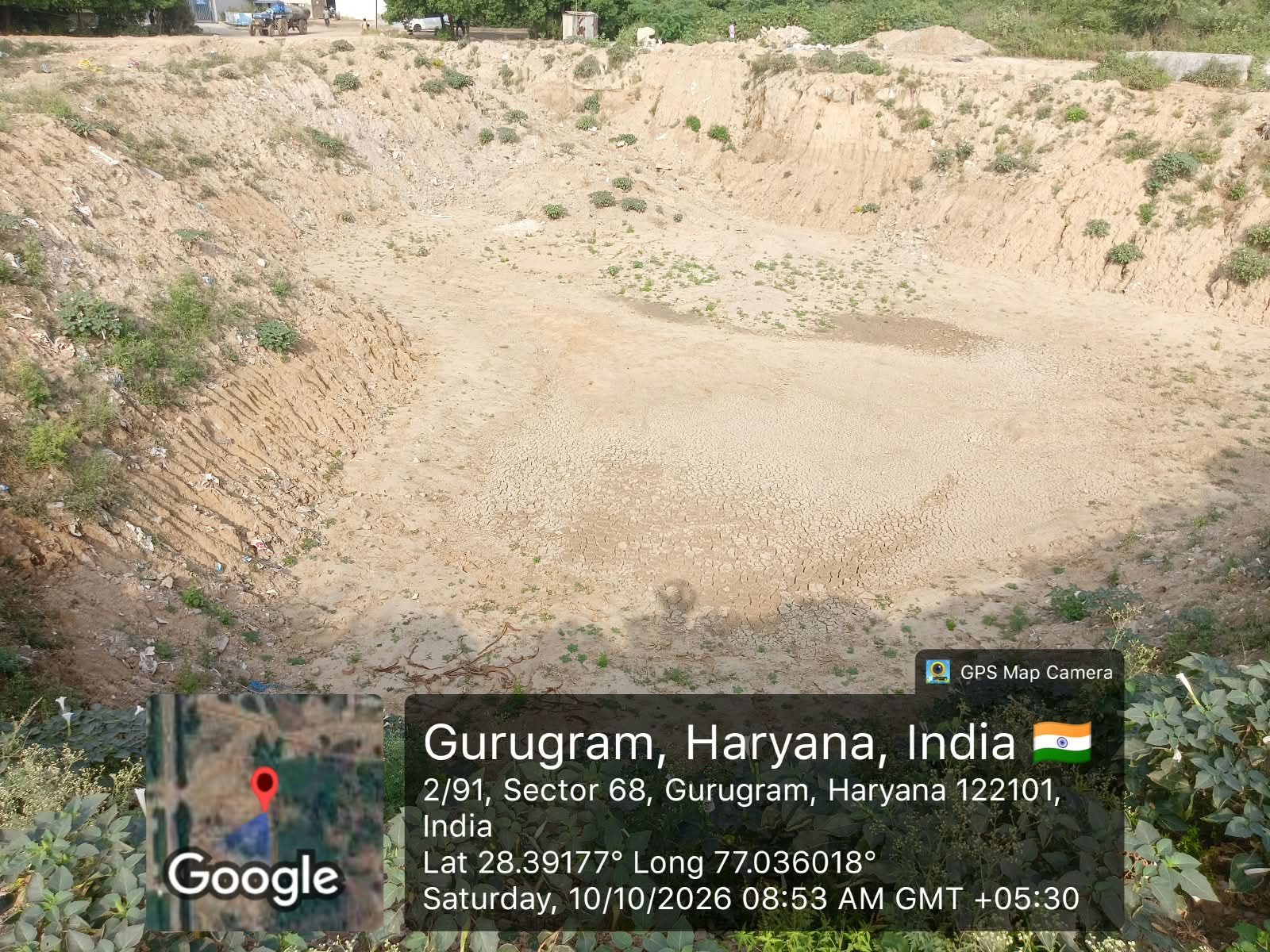
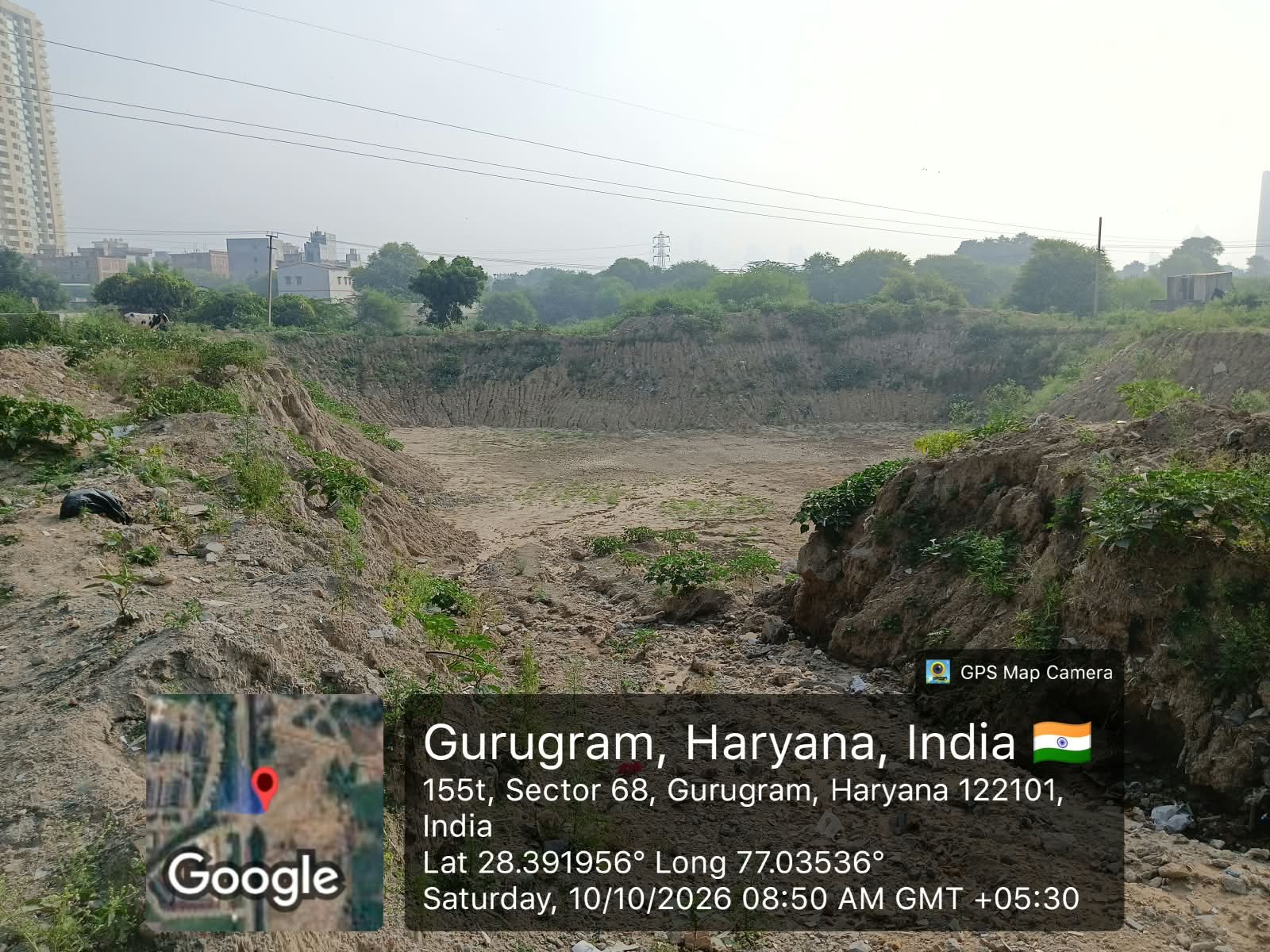
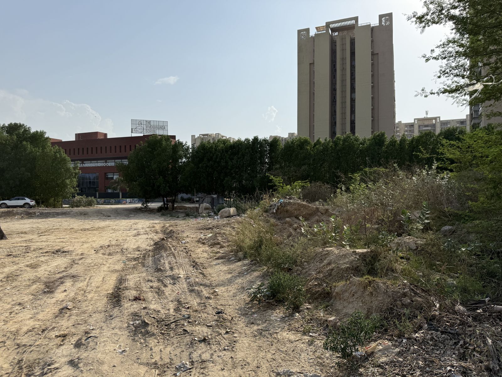
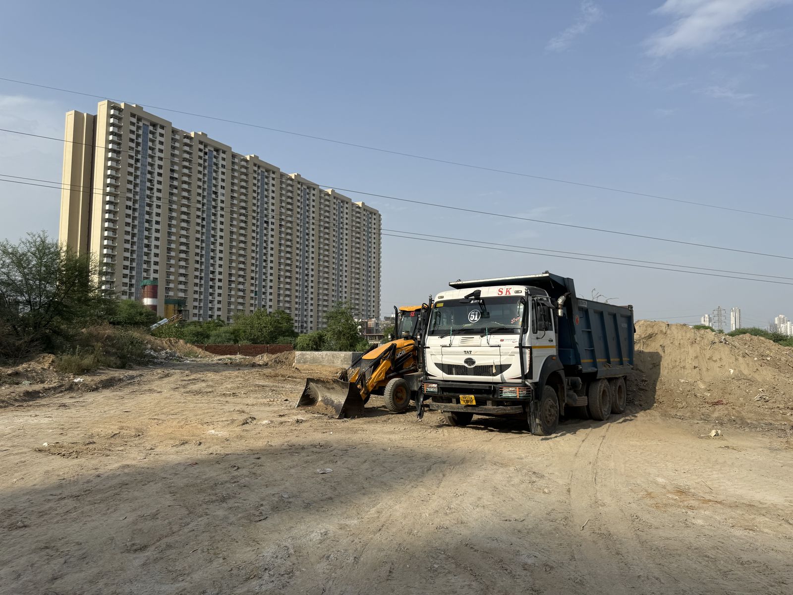
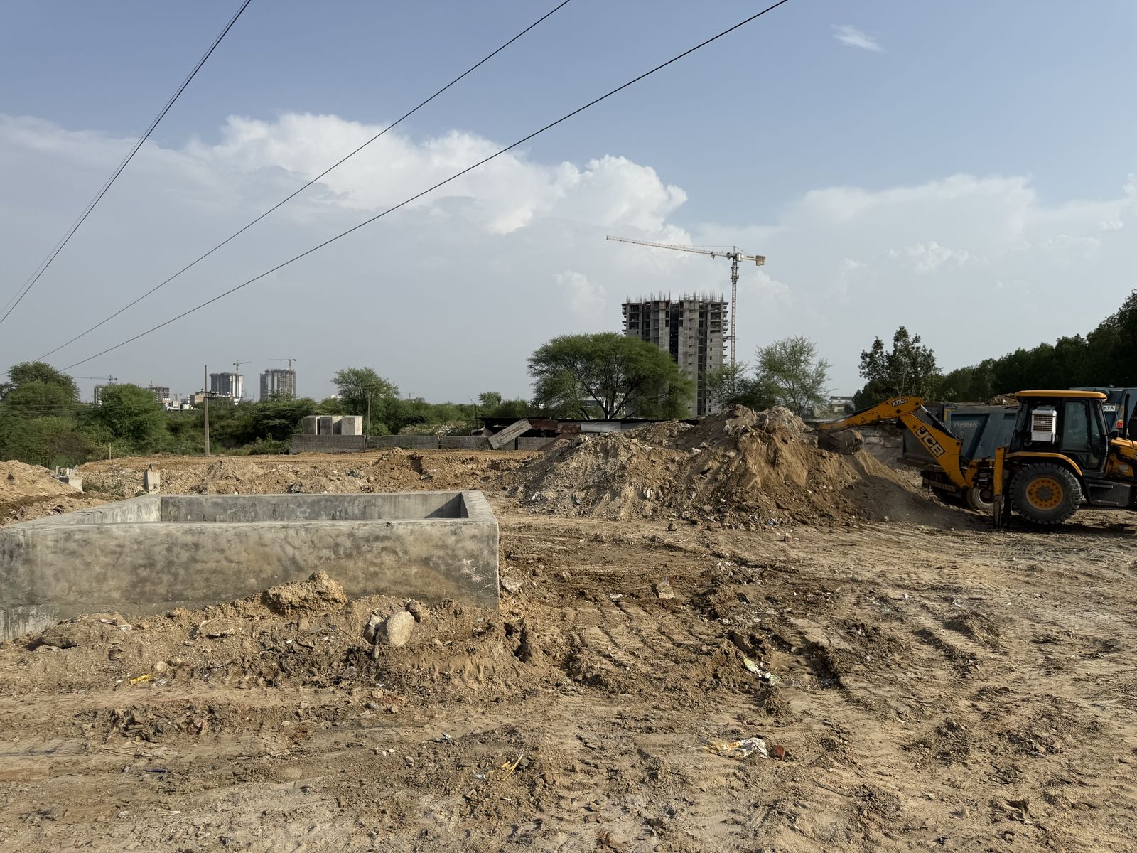
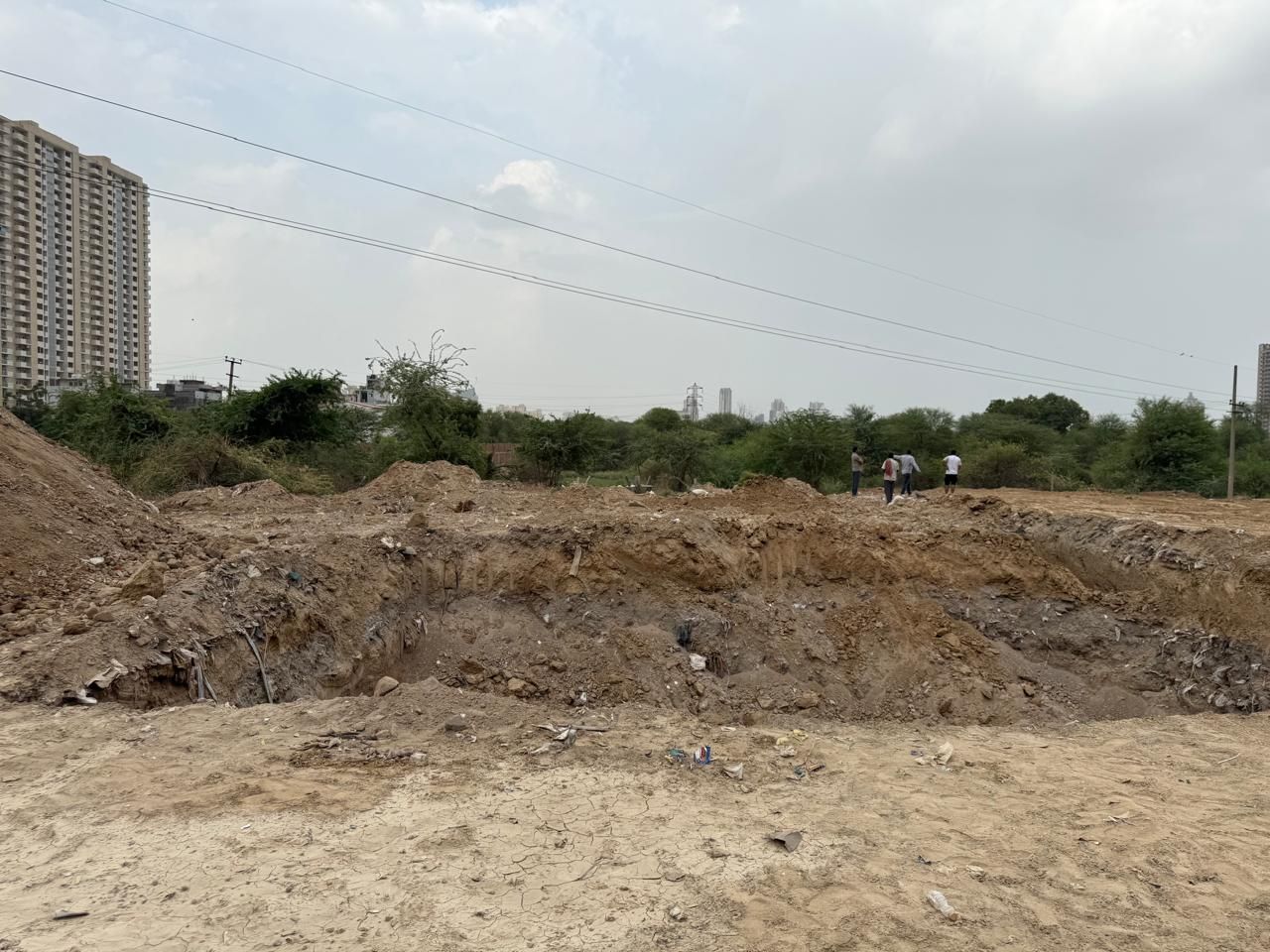
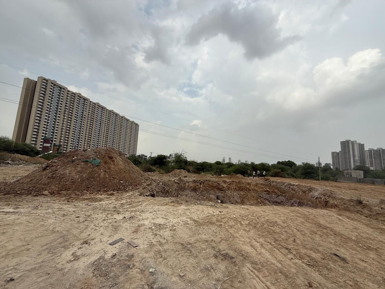
Over the years, the pond became a dumping ground for household waste, construction rubble, and debris. When the project began it was dry, compacted, and completely buried. The main excavation of the pond bed is now done. The banks are to be shaped next, and a plantation drive will follow.
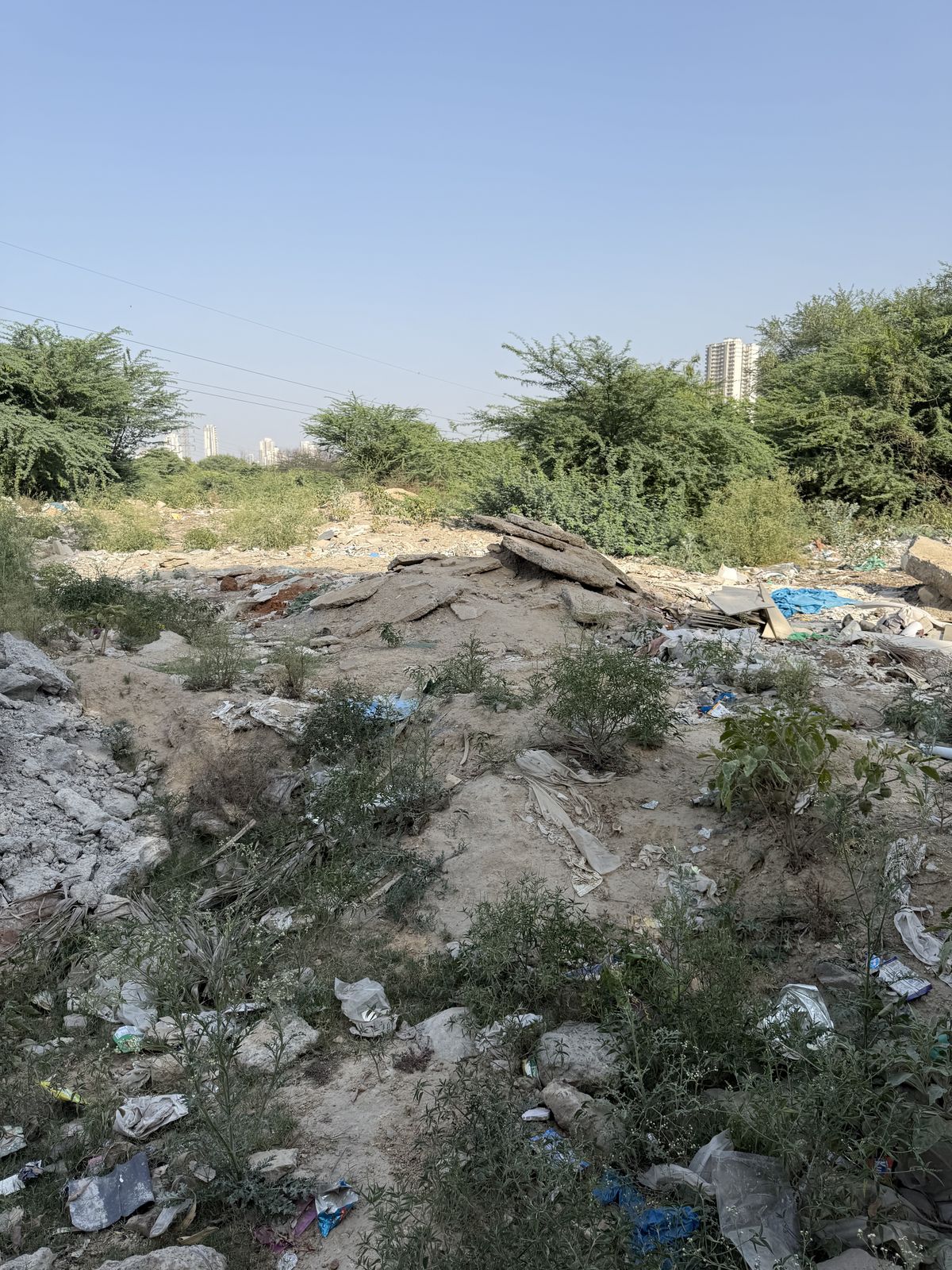 Before restoration, April 2026
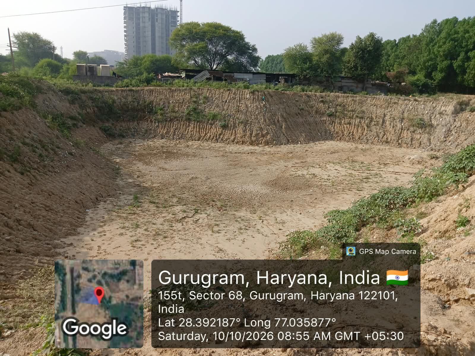 Excavated, October 2026
The Pond and Its Surroundings
The pond sits between three kinds of land: high-rise housing and a school to the west, village housing to the north, and open scrub and farmland to the east and south. A second pond, a johad, lies about 520 m to the north-east.
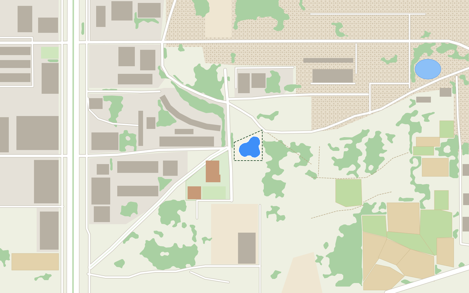
Swipe sideways to see the whole map.
- Buildings
- Village housing
- Trees and dense scrub
- Farmland
- Open land
- Water
- The plot
- Badshahpur Pond. The project site at 28.392056°N, 77.035325°E. The dashed line is the plot and the blue shape is the pond, placed from the layout plan and the geotags of site photographs, so its position is approximate.
- 1The Vivekananda School. About 120 m to the south-west, across the road.
- 2Tulip Violet. Residential towers about 100 m to the west, across the road. Tulip Lemon lies beyond them to the north-west and Tulip Yellow to the north.
- 3Darbaripur Road. About 290 m to the north, lined with village housing.
- 4Johad. A second pond, about 520 m to the north-east.
- 5Farmland. Cultivated fields from about 250 m to the east and south-east.
- 6Open land. Scrub and vacant plots adjoining the site to the east and south.
- 760 Meter Road. A main sector road about 480 m to the west, with shopping centres along it.
The Planned Layout
This is the layout planned for the finished pond. The basin has been excavated. The banks, planted shelf, inlets, outlet and planting are still to be built.
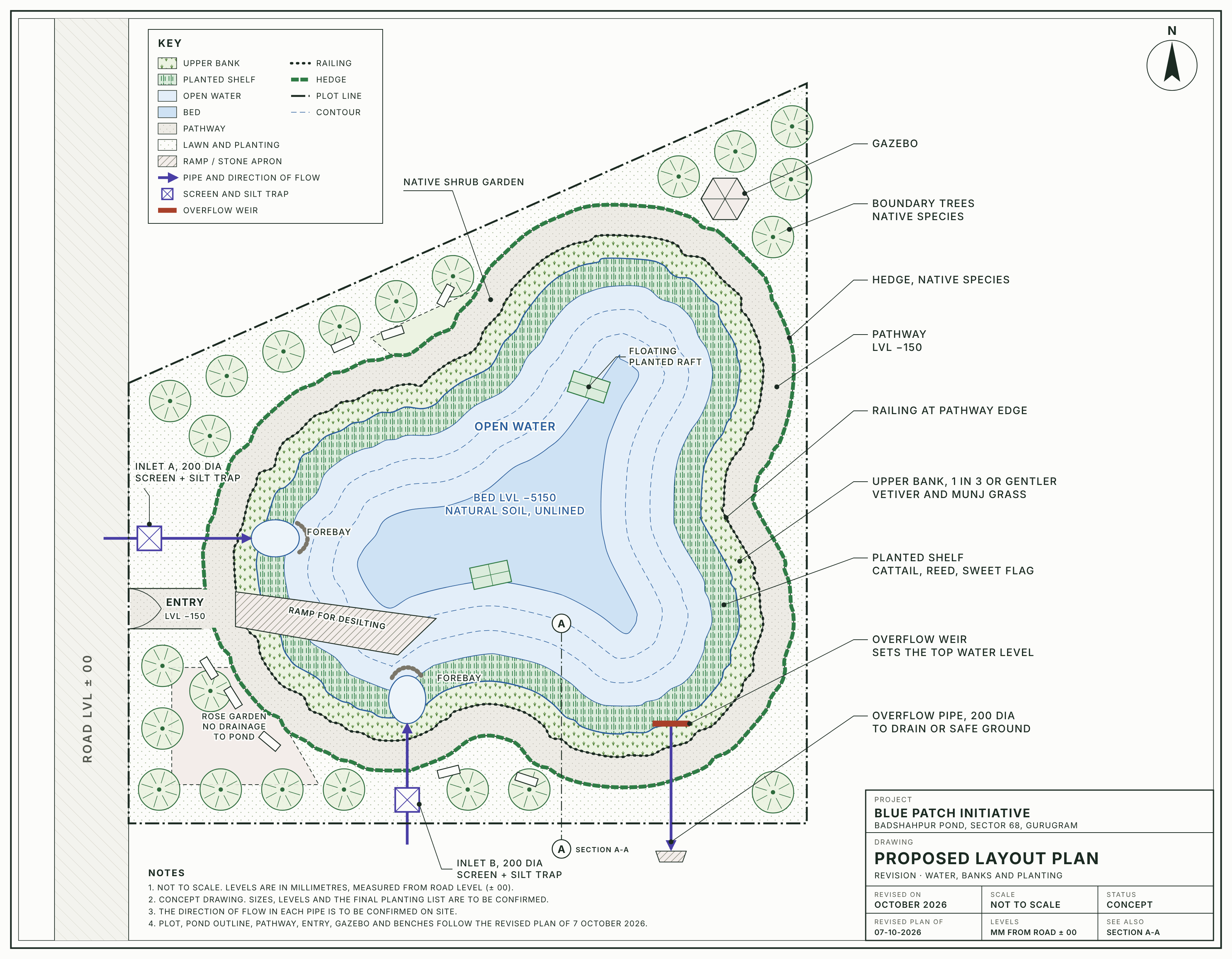
What is planned
- Water in. Two inlets, each with a screen for litter, a chamber where silt settles, and a stone-lined forebay at the foot of the bank.
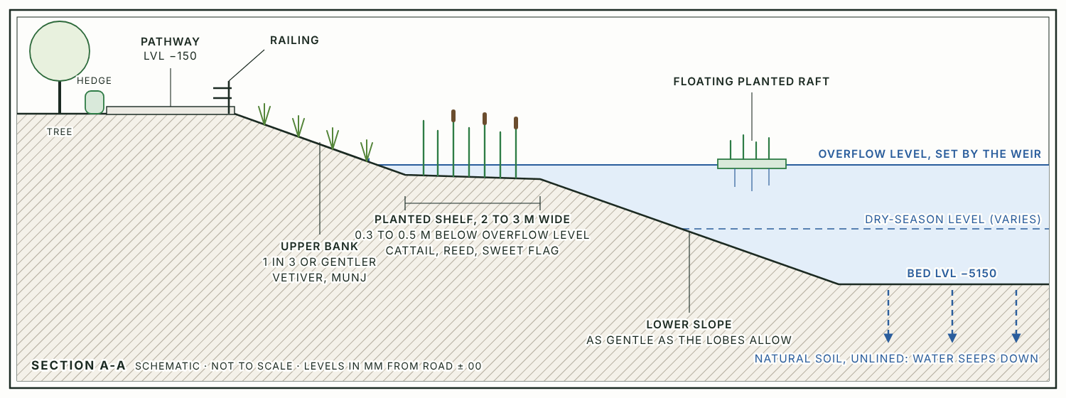
- Water out. An overflow weir that sets the top water level below the pathway, with a pipe to a drain or safe ground.
- Banks. A planted upper slope, then a level planted shelf just under the overflow level, right round the pond.
- Bed. Natural soil, left unlined so that water can seep down to the aquifer.
- Access and safety. A single entry from the road, a pathway round the pond with a railing, and a ramp to the bed for yearly desilting.
- Planting. Native trees on the boundary, a native hedge and shrub garden, vetiver and munj grass on the bank, and cattail, reed and sweet flag on the shelf.